Thermal Imaging of America offers aerial infrared imaging through our membership in the Network!
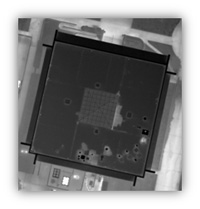
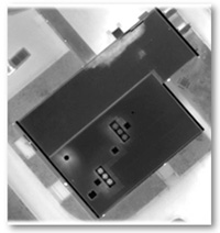
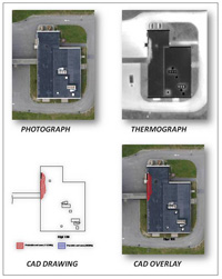
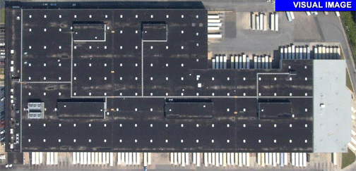
Aerial IR Surveying Visual photographs are taken earlier in the day or the next day. Both visual and infrared images are used to do the analysis by overlaying the AutoCAD drawing of the roof 'over' the digitized photographs and thermographs. The drawings are created indicating areas of suspected moisture contamination.
The result is a report where visual, infrared and AutoCAD Components are well-matched and lined-up.
To learn more about infrared surveying...CLICK HERE.